


Col de Chalence3

ARPF1
User
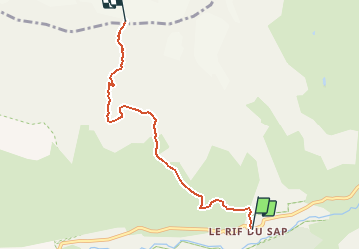

Length
5.2 km

Max alt
3001 m

Uphill gradient
1592 m
Km-Effort
21 km

Min alt
1418 m

Downhill gradient
20 m
Boucle
No
Creation date :
2020-02-23 11:18:23.724
Updated on :
2020-02-23 11:19:29.385
--
Difficulty : Difficult

FREE GPS app for hiking
 SityTrail
IGN / Geographical institutes
SityTrail Plus
The world is yours!
About
Trail On foot of 5.2 km to be discovered at Provence-Alpes-Côte d'Azur, Hautes-Alpes, La Chapelle-en-Valgaudémar. This trail is proposed by ARPF1.
Positioning
Country:
France
Region :
Provence-Alpes-Côte d'Azur
Department/Province :
Hautes-Alpes
Municipality :
La Chapelle-en-Valgaudémar
Location:
Unknown
Start:(Dec)
Start:(UTM)
283510 ; 4967369 (32T) N.
Comments